Take a Relaxing Motorcycle Ride to Alabama's Rugged Little River Canyon
Don't let the name fool you! Little River Canyon is big, beautiful and a great motorcycle
destination. Chiseled from the Appalachian Mountains in northeast Alabama, Little
River Canyon offers plenty to do almost anytime of the year. You'll enjoy a relaxing
backroad motorcycle ride with enough turns, twisties and sweepers to keep your attention
and make the ride slip by before you know it!
Desoto State Park
Little River Canyon National Preserve and Alabama's DeSoto State Park offer scenic views,
fun motorcycle roads, great pull-offs and plenty of off-the-bike activities.
The state park offers camping, log cabins, motel rooms and more for just about every budget.
Visit the Desoto State Park Website to review rates lodging
and information about the park and its facilities.
Ride Maps and Directions
We are working on getting our detailed ride maps and directions ready. They swill
be posted soon.
Until we get the detailed directions posted you can follow US-411 out of Centre Alabama to SR-68.
Then use either SR-273 to CR-275 (may be rough with some gravel) or SR-176 to the Little River Canyon area.
| Little River Canyon in northeast Alabama is one of the south's great gems. Everywhere you look there's another spectacular view, many with great hiking trails. Just far enough from Atlanta, Birmingham and Chattanooga to remain relatively unknown you'll find plenty of uncrowded picnic and hiking spots. Surrounded by great country roads, Little River Canyon ranks as one of the best year-round motorcycle ride destinations you can find! | 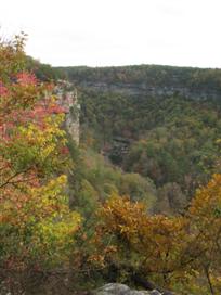 |
| Little River Falls is just one of the many great places to stop. | 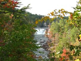 |
| The canyon road attracts plenty of bikes. There was a lot of crud in this corner so everyone who wasn't looking through the corner got a bit of a surprise. | 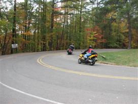 |
| Coming in from the Lookout Mountain Parkway via Dogtown things start to pickup at the Eberhart Point Overlook. This is also a great picnic and hiking spot. |  |
I've avoided taking the back route into the park via county road 275. Based on other online reviews and information like this posted in the park, I thought that this route was gravel. However, from what I can see on Google Maps and my pictures, it looks like CR-275 is paved all the way in. There do appear to be a few spots where sand and gravel may encroach in the turns though. With reasonable care I don't think most bikes would have a problem, however I have not yet verified this in person.
I will include directions via both CR-275 and the Lookout Mountain Parkway. On my next trip up this way I'll checkout CR-275 and post some new photos.
If you have any information or comments on the back route please send me an email or give us a call.
View the warning in LARGE format | 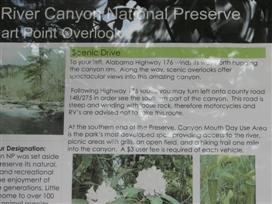 |
Here's the detailed area information as posted at Eberhardt Overlook.
View the Eberhart Point Overlook information in a LARGE format. | 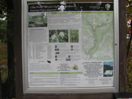 |
Eberhart trail information as posted at the trail head. The first time we hiked down we met a young couple on their way up. When I asked him how tough the return trip was he said 'If I knew someone with a helicopter I'd be calling him now!' We can tell you from experiences the trip up is way harder than the trip down, but it was worth it.
View the Eberhart Point Trail information in a LARGE format | 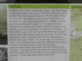 |
| Here's a shot from the overlook at Eberhart Point. If you look closely just to the right of center in the photograph you can see a home built at the top of the canyon. | 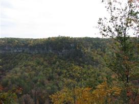 |
| Here it is telephoto. There's one magnificent view from that porch! | 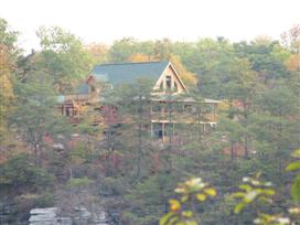 |
| We decided to hike down to the river at Eberhart Point. | 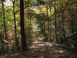 |
| It's easy going on the way down. After couple of hundred feet you find yourself in a different world. | 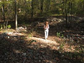 |
| Close to the river there are a couple of picnic tables. This is a great place to take your lunch break (and work it off on the walk back to the top of the canyon). | 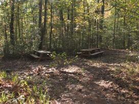 |
| With the low water in 2007 we were able to walk anywhere we wanted to. During high water you may need to be more careful. | 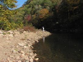 |
| These boulders are even more impressive up close. We really never expected this kind of scenery in Alabama. | 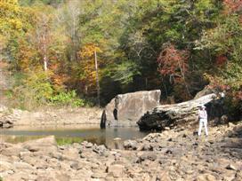 |
| Remember that house in the earlier picture. Here's another view of it from the riverbed. It's at the top of that cliff at the top right of the picture. | 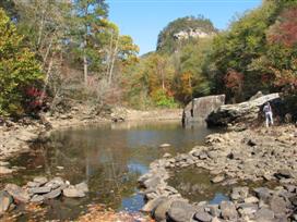 |
| The more I saw of this house the more I liked it. I'd imagine that porch is one great place for your morning coffee. | 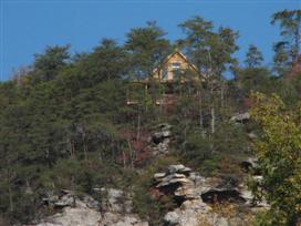 |
| Anna got me to climb up on this rock to enjoy the solitude of the river at the bottom of the canyon. | 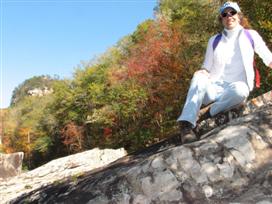 |
| With the low water the river was more a stream. We didn't hike down in 2009, but from what we could see from the canyon rim it didn't look like you could hop rocks to the other side of the river! | 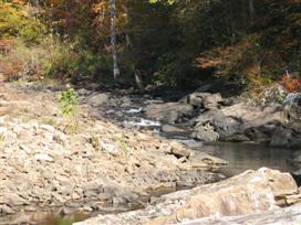 |
| I doubt many people could identify this picture as having been taken in Alabama. This place will surely change how you think about the Heart of Dixie. | 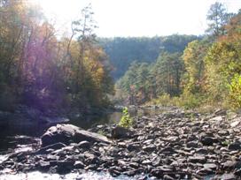 |
| Down at the bottom of the canyon the leaves were constantly drifting down and settling on the water. The serenity of this place made it hard to leave. The reflection of the trees in the water reminds me of an impressionist painting. | 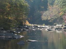 |
| Heading back to the top I only fell so far behind because I was taking pictures! It sure seems steeper on the way back up. Now you know why they put several benches along the trail. I know I needed them. Also, be sure to take a couple of bottles of water for each person. Even in the fall we were happy we had plenty of water on the way back. | 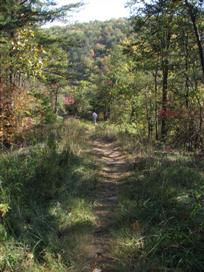 |
| If you don't feel up to the hike you can check things out from the overlook, however as long as your comfortable with a little exercise you'll find the hike well worth the effort. | 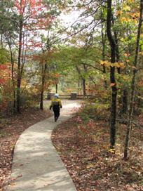 |
| Scenic pull-outs and overlooks are located throughout the canyon. Many features picnic tables and all have incredible views. This is the Wolf Creek Overlook just north of Eberhart Point. | 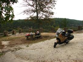 |
| This picture in 2009 shows the view back towards Eberhart Poin from the Wolf Creek Overlook. There had been plenty of rain and the river had lots of white water | 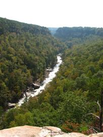 |
| The view looking looking towards the Canyon View Overlook from the Wolf Creek. | 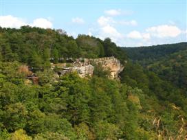 |
| This telephoto of the picture above shows how massive the cliffs in the canyon are. | 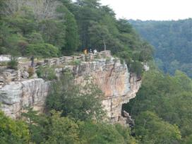 |
| The view downstream from the Wolf Creek Overlook | 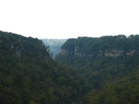 |
| The cliffs on the far side of the canyon make a great backdrop for lunch. | 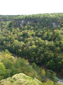 |
| This is the Little River Falls Overlook. The boardwalk leads to an excellent vantage point to the see the falls. This is one of the more popular stops in the park, but worth a look. | 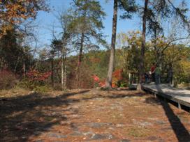 |
| We noticed this 'unathorized' path to the left of the boardwalk. | 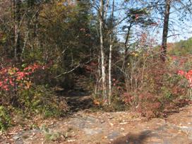 |
| Less than 100 feet down the path it lead to the edge of the canyon. | 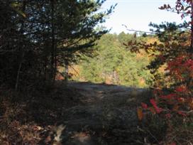 |
| Be careful! It's a long way down. | 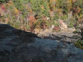 |
| At the end of the path there's a nice place to sit and enjoy the view. | 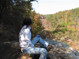 |
| The view is beautiful anytime of the year. In the fall it's stunning. We spent quite while here just admiring the colors and the solitude. | 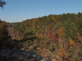 |
| In 2007 people were able to walk almost all the way across the river. Notice the high water mark on the bridge support. | 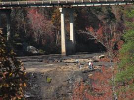 |
| Here's the falls in autumn 2007. There had been a record drought and there was very little flow to the river. | 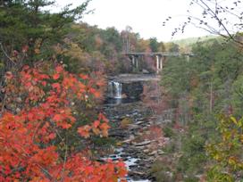 |
| The view of the falls from the Little River Falls Overlook in in early november of 2009. The falls in 2007 were just a trickle compared to this! | 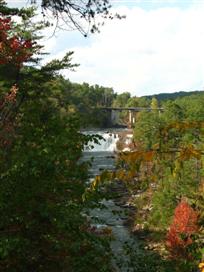 |
| Last updated 10/23/2009 | |